
Highlighting Oregon's WildLands
Oregon is a wonderful state. It is beautiful and it is wild. Mountains, ancient forests, clear waters and wildlife. But most of Oregon's incredible wildlands are not protected, and therefore are in serious danger of irreparable destruction. The purpose of this site is to raise awareness of Oregon's wildlands through selected 3D map-based 'spotlights.' This site will be updated and new 'spotlights' will be added over time, so be sure to check back every now and then to see what's going on.
SPOTLIGHTS
 v0.9.2Beta
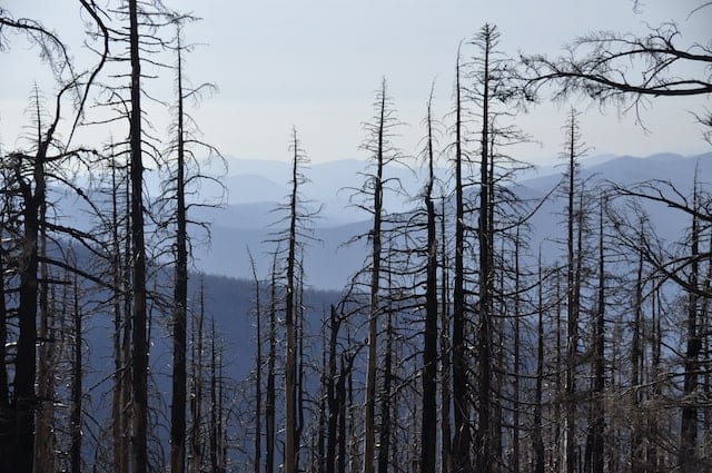
Photo by the Hilde Morin
In the Pacific Northwest, fire is a natural part of healthy forests. Since 2004 the Federal Government, through the Monitoring Trends in Burn Severity (MTBS) program, has been conducting detailed wildfire severity assessments by analyzing before and after LANDSAT satellite images of fire boundaries.
This 'spotlight' shows the history of wildfires in Oregon and their severity since 1984.
This 'spotlight' shows the history of wildfires in Oregon and their severity since 1984.
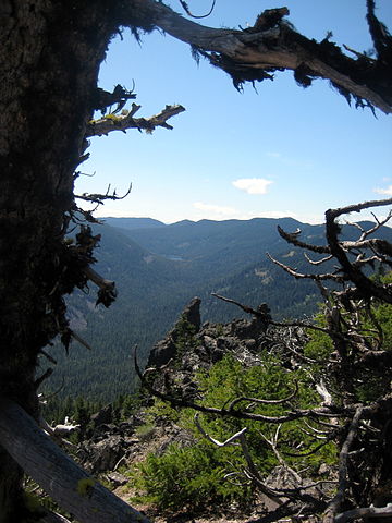
Photo by Wikipedia user Axcordion
Did you know that Oregon has the least amount of proportional protected wilderness area as compared to California and Washington? 4% versus 15% and 10% respectively!
Using this 'spotlight' you can explore potential forest wilderness areas that would raise Oregon to be on par with its neighbors.
Using this 'spotlight' you can explore potential forest wilderness areas that would raise Oregon to be on par with its neighbors.
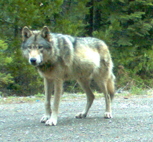
Photo by the Oregon Department of Fish and Wildlife
In 2011 a wolf by the name of OR-7, Journey, decided to break away from its pack in Northeast Oregon and march over 1,000 miles all the way to California through wilderness and roadless areas looking for a mate to establish his own pack. OR-7 had a GPS collar, so his route has been thoroughly recorded.
This 'spotlight' shows the incredible journey of Wolf OR-7.
This 'spotlight' shows the incredible journey of Wolf OR-7.
In Oregon, in addition of having a disproportionately small amount of protected wilderness areas, they are under constant threat of damage and destruction. In addition to systemic environmental threats, there are many localized hazards such as logging, road development, and industrialization plans that are threatening Oregon's pristine wildlands.
This 'spotlight' maps a small sample of recent localized threats facing Oregon's wildlands, wildlife and waters.
This 'spotlight' maps a small sample of recent localized threats facing Oregon's wildlands, wildlife and waters.
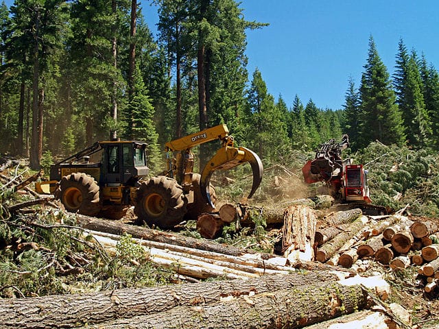
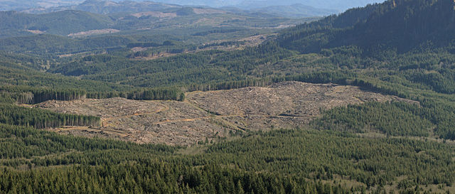
Photo by Bureau of Land Management
Did you know that for a very long time there has been, and there still is, a large amount of logging in Oregon's public lands like National Forests? This 'spotlight' displays areas logged and shows animations of logging activities over time.
Although the data being reported by the federal agencies is not complete, especially going back in time, the 'spotlight' gives a good idea of logging activities in public lands.
This 'spotlight' is also available as a standalone site here.
Although the data being reported by the federal agencies is not complete, especially going back in time, the 'spotlight' gives a good idea of logging activities in public lands.
This 'spotlight' is also available as a standalone site here.

Photo by Wikipedia user Finetooth, Source, CC BY-SA 3.0
The majority of the water usage in Oregon comes from rivers, streams and lakes.
This 'spotlight' allows you to pick a spot on the map and visualize interconnected populations and communites by way of common drinking watersheds.
This 'spotlight' is also available as a standalone site here.
This 'spotlight' allows you to pick a spot on the map and visualize interconnected populations and communites by way of common drinking watersheds.
This 'spotlight' is also available as a standalone site here.